Define
Establish
Site conditions, boundaries, objectives, deadlines, and the review path.
Import
DWG and DXF drawings, PDF plans, tree inventories, and planting information.

Software for site design, tree care, landscape and wildfire planning. Bring your drawings and field observations together, from the first review to ongoing care.
 Part of the arborbase living record ↗
A clear workflow for owners, designers, arborists, wildfire specialists, contractors, and property teams, with one place to follow decisions as the project changes.
Site conditions, boundaries, objectives, deadlines, and the review path.
DWG and DXF drawings, PDF plans, tree inventories, and planting information.
CRZ and SRP impacts, planting compliance, and wildfire prescriptions.
Jurisdiction-specific requirements from the embedded ordinance library; connect revisions and responsibilities.
Progress photographs, installations, substitutions, assignments, and approvals.
Drawing revisions, field changes, completion evidence, and remaining evidence gaps.
Plans, impact calculations, reports, and field evidence with the jurisdiction’s arborist and municipal reviewers when needed.
Approved prescriptions and care commitments for maintenance, monitoring, and reinspection.
Decisions with real consequences
Use the embedded ordinance library to place jurisdiction-specific tree, vegetation, wildfire, and permit requirements in the drawing context where decisions are made.
Overlay existing trees, proposed landscape, structures, and defensible-space zones on imported drawings.
Measure Critical Root Zone (CRZ) and Structural Root Plate (SRP) impacts against proposed work and flag conflicts for review.
Export reviewed CAD layers (DWG and DXF), PDF plan sets, CSV schedules, and GIS-ready GeoJSON overlays.
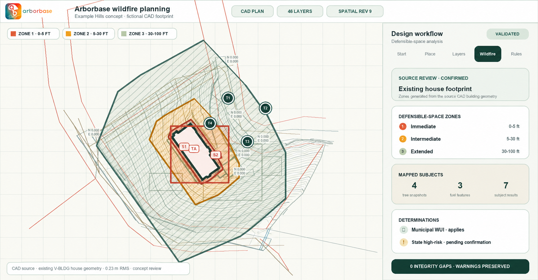
Review defensible-space zones alongside structures and vegetation. Keep mitigation recommendations tied to the locations and conditions they address.
At closeout, the property team receives the approved plan, verified changes, care responsibilities, and open obligations without rebuilding the record.
Requirements, linked source records, decisions, prescriptions, owners, and rationale.
Progress evidence for tree removals and care, landscape installations, materials, substitutions, and approvals.
Protection, establishment work, assignments, timing, and open obligations.
Monitoring, reinspection, maintenance history, and evidence for the next review.
Walk through your project workflow with us and see where Design fits.